From seaports to the deep blue sea, bathymetry matters on many scales

efgboblique
By Rear Adm. Shep Smith, Director of the Office of Coast Survey

On Thursday, June 21, we celebrate World Hydrography Day. This year’s theme—Bathymetry – the foundation for sustainable seas, oceans and waterways—is very timely as many hydrographic organizations worldwide are focusing on bathymetry at local and global scales. While we work to perfect real-time data and high-resolution bathymetry for ports, we are still working to build a foundational baseline dataset of the global seafloor. Our work at both scales have implications for the local and global economies.

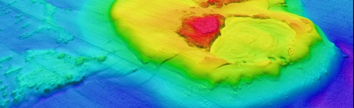
Let me start with the global seafloor. For the untrained eye, particularly those looking at a Google Earth image, it would appear that the monumental task of mapping the seafloor is accomplished. Geologic features appear detailed under a deep sea of blue. Little do most people know, however, that the majority of this surface is interpolated. In other words, we do a good job filling in the blank spaces between the sparse depth measurements we have. This creates a pretty picture, but does not provide valuable and much needed data for resource management, offshore energy planning, mineral extraction, and other fields of research that require high-resolution data to do meaningful work and build on existing scientific knowledge. In fact, the United Nations proclaimed a Decade of Ocean Science for Sustainable Development (2021-2030) and calls for an increase in scientific knowledge of the ocean to support the sustainable management of marine resources and development of the blue economy. 

gap analysis
Gap analysis of bathymetric data coverage in the U.S. exclusive economic zone (coverage indicated in purple).

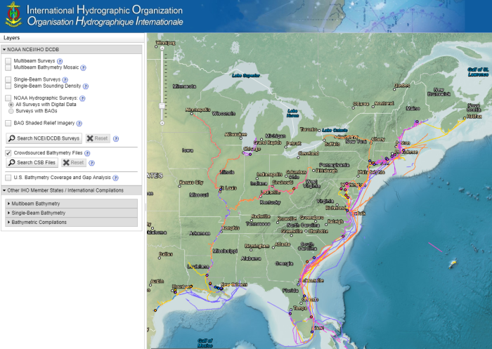
Here in U.S. waters, we are working to help fill these gaps by supporting the Seabed 2030 initiative and maximizing the societal value of the data that is collected. Using multibeam echo sounders that survey large swaths of the ocean floor, we can collect a tremendous volume of bathymetry data along with water column and acoustic backscatter data aiding in habitat mapping. There is also increasing activity in seabed mapping to support offshore wind development and seabed minerals mining. Further, we are working with partners, state and federal agencies, and citizen science and crowdsourced programs to coordinate the collection and sharing of data. These efforts enable us to work toward increasing the breadth of data collection by covering an expanded geographic scope but also the depth of data by collecting data beyond simply bathymetry.

IMG_3484
Rear Adm. Shep Smith (while serving as commanding officer of NOAA Ship Thomas Jefferson) discusses bathymetric data collection with Erin Weller, a physical scientist with Coast Survey.

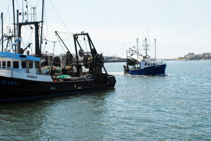
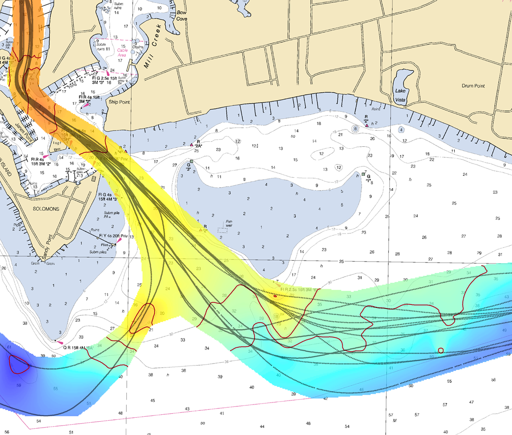
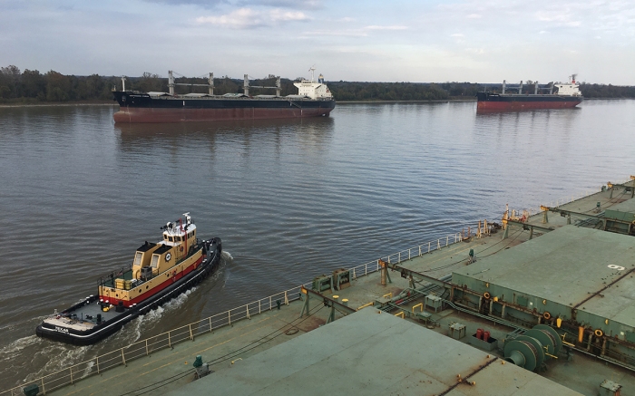
Zooming in from the global scale to individual ports, our focus changes. Our concern is no longer building a baseline dataset for longer-term research needs but getting ships in and out of port in the safest and most efficient way possible. Based on the success of the Long Beach pilot project, NOAA offices involved with precision navigation were awarded additional funding to support foundational program management, and established a dedicated team to support the expansion of precision navigation to more ports throughout the country in the coming years. 

Ocean Wind - 6 (1)
View from the M/V Ocean Wind as the ship transits down the Mississippi River. This region is the most congested waterway in the world as more than 10,000 ships pass through the port complexes between New Orleans to Baton Rouge each year. Plans are underway to implement precision navigation in the Lower Mississippi River Port Complex as well as in the Port of New York/New Jersey.

Whether working on the building blocks of a global high resolution bathymetric data set or customizing precision navigation port-by-port, the key to success is standardization. The latest edition of the International Hydrographic Organization’s (IHO) S-100 framework—increased standardization of maritime data products—will be published this December. NOAA plans to develop new services in line with these new standards, which will begin a new era in electronic navigation. 

It is an interesting time in our field. We are still learning, still discovering, still building. We are working every day toward mapping the ocean and developing precision navigation for our major ports. The global community first recognized World Hydrography Day in 2005 when the United Nations General Assembly adopted Resolution A/60/30. We have made a lot of progress in the past 13 years. In another 13 year’s time, we will have just surpassed the 2030 mark. I anticipate that by that time, we will be able to review with pride both our improved understanding of the ocean and sustainable growth of our blue economy.


We are celebrating World Hydrography Day all week! Check our website to see new hydrography- and bathymetry-related stories added each day.

NOAA announces launch of crowdsourced bathymetry database

By Lt. Cmdr. Adam Reed, Integrated Oceans and Coastal Mapping (IOCM) Assistant Coordinator

Today NOAA announces the end of a testing phase in the development of a new crowdsourced bathymetry database. Bathymetric observations and measurements from participants in citizen science and crowdsourced programs are now archived and made available to the public through the International Hydrographic Organization (IHO) Data Centre for Digital Bathymetry (DCDB) Data Viewer. The operationalized database allows free access to millions of ocean depth data points, and serves as a powerful source of information to improve navigational products.

The crowdsourced bathymetry database, displayed in the IHO Data Centre for Digital Bathymetry Data Viewer, has an updated user interface.

NOAA began database development in 2014 with the IHO Crowdsourced Bathymetry Working Group. The database is part of the IHO DCDB and is hosted at NOAA’s National Centers for Environmental Information (NCEI), which offers access to archives of oceanic, atmospheric, geophysical, and coastal data. Sea-ID, a maritime technology company, provided early testing and support and is currently working to encourage data contributions from the international yachting community. Ongoing participation from Rose Point Navigation Systems, a provider of marine navigation software, helped kickstart the stream of data from a crowd of mariners.

The crowdsourced bathymetry database now contains more than 117 million points of depth data, which have been used by hydrographers and cartographers to improve chart products and our knowledge of the seafloor. NOAA, working with George Mason University, is using the database depths to assess nautical chart adequacy, determine when areas require updated survey information, and identify chart discrepancies before an incident occurs. The Canadian Hydrographic Service used this dataset to update several charts of the Inside Passage, a network of coastal routes stretching from Seattle, Washington, to Juneau, Alaska.

Data are contributed to the database through a variety of trusted sources (e.g., partner companies, non-profit groups)—referred to as “trusted nodes”—that enable mariners to volunteer seafloor depths measured by their vessels. Contributors have the option to submit their data anonymously or provide additional information (vessel or instrument configuration) that can enrich the dataset. The trusted node compiles the observations and submits them to the crowdsourced bathymetry database, where anyone can access the near real-time data for commercial, scientific, or personal use.

Mariners provided millions of bathymetry data points to the crowdsourced bathymetry database by voluntarily submitting the depth data collected by their vessels.

NOAA invites maritime companies to support this crowdsourcing effort in their systems by making it simple for users to participate. For example, Rose Point Navigation Systems further promoted the IHO crowdsourced bathymetry initiative by moving the option to collect and contribute bathymetry data to a more visible section of their program options menu.

By submitting crowdsourced bathymetry data, mariners provide a powerful source of information to supplement current bathymetric coverage. Nautical charts need to be updated as marine sediments shift due to storm events, tides, and other coastal processes that affect busy maritime zones along the coast. Crowdsourced bathymetry data helps cartographers determine whether a charted area needs to be re-surveyed, or if they can make changes based on the information at hand. In some cases, crowdsourced bathymetry data can fill in gaps where bathymetric data is scarce, such as unexplored areas of the Arctic and open ocean and also shallow, complex coastlines that are difficult for traditional survey vessels to access. Crowdsourced bathymetry data is also used to identify dangers to navigation, in which case NOAA can issue a Notice to Mariners about the navigation hazard within 24 hours.

The utility of crowdsourced bathymetry data extends beyond the territory of the United States and into international mapping efforts. Seabed 2030 is a global mapping initiative to produce a complete, high-resolution bathymetric map of the world’s seafloor by 2030. GEBCO (which operates under the IHO and International Oceanographic Commission) and the Nippon Foundation launched the initiative in 2017, and received NOAA-wide commitment of resources and support.

Seafloor mapping is integral to many NOAA products, and crowdsourced bathymetric data supports NOAA’s Integrated Oceans and Coastal Mapping (IOCM) initiatives to maximize potential sources and use of mapping data. Crowdsourced efforts are poised to become a major source of information for improving nautical chart coverage and accuracy, and the crowdsourced bathymetry database contributes to national and international seafloor mapping efforts as a growing repository of bathymetric data.

Any mention of a commercial product is for informational purposes and does not constitute an endorsement by the U.S. Government or any of its employees or contractors.

Beta test of crowdsourced bathymetry holds promise for improving U.S. nautical charts

We are on the verge of acquiring a significant new source of data to improve NOAA nautical charts, thanks to an enthusiastic industry and mariners equipped with new technology.

By Lt. Adam Reed, Integrated Oceans and Coastal Mapping (IOCM) Assistant Coordinator

The United States has about 3,400,000 square nautical miles of water within our coastal and Great Lakes jurisdiction. Coast Survey, who is responsible for charting that vast area, averages about 3,000 square nautical miles of hydrographic surveying each year. The data collected by those surveys update over a thousand NOAA charts. However, hydrographic surveys are expensive and laborious, and so Coast Survey directs them toward the highest priority sites, which leaves many coastal areas without updates for many years.

Coast Survey may soon get new sources of information, provided voluntarily by mariners, which will alert cartographers to areas where shoaling and other changes to the seafloor have made the chart inaccurate.

Rose Point Navigation System beta tests new crowdsourcing database

Technology has reached the point where any boater can buy an echo sounder kit, add a GPS system, record depth measurements, and make their own geospatial observations in a common reference frame. The question then for hydrographic offices (who are concerned with improving nautical charts for safe navigation) becomes “how do we take advantage of that?”

Rose Point Navigation Systems is working with system developers at NOAA’s National Centers for Environmental Information (NCEI) and with hydrographic experts at Coast Survey and others who are collaborating on an international effort to maintain crowdsourced bathymetry. In a beta test released on May 13, 2016, Rose Point has added a new feature to Coastal Explorer that gives users an option to send anonymous GPS position and soundings data to a new international database managed by NCEI. After getting permission from users, Rose Point systems will generate data log files of positions, depths, and time, and automatically transmit the files to the data center, where Coast Survey can pull the data to compare it to nautical charts.

Crowdsourced bathymetry is an international project

Using data from private sources is not new for Coast Survey. Private interactive cruising guides and other internet-based enterprises have set up services that allow commercial mariners and recreational boaters to share information about navigation hazards they see (or experience) while on the water. The United States Power Squadrons and the U.S. Coast Guard Auxiliary have a decades-long tradition of sharing updates through our cooperative charting programs. But the lack of appropriate software and integration between sources has hampered efforts to use the information to its full potential.

Hydrographic offices around the world are re-thinking crowdsourced bathymetry. In October 2014, Coast Survey led the U.S. delegation to the Fifth Extraordinary International Hydrographic Conference, with Rear Admiral Gerd Glang at the helm. At this meeting, the U.S. and France jointly proposed an initiative (see Proposal No. 4) that introduced crowdsourced bathymetry as a recognized source of data for nautical charts. One of the results of that initiative was the formation of the IHO Crowdsourced Bathymetry Working Group (IHO CSBWG) that set out to develop crowdsourcing principles and guidelines, and then offer a platform for sharing best practices around the world.

Working hand-in-hand with NCEI, the working group has developed a database that can receive volunteered bathymetric data. Data can come from anyone in the world, and everyone can access it.

Coast Survey will use crowdsourced bathymetry to assess chart accuracy

Crowdsourced reports serve an important role in focusing attention on trouble areas. The data helps cartographers determine whether a charted area needs to be re-surveyed, or if they can make changes based on the information at hand. Even with very sparse data, cartographers can make improvements to nautical charts.

Agreeing in principle to use crowdsourced data is much different than applying the system to the vigor of data transmission from moving vessels, however, so Coast Survey experts contributed hydrographic expertise and system testing. Using Rose Point’s Coastal Explorer, Coast Survey Research Vessel Bay Hydro II transmitted “crowdsourced” data using log files that were automatically produced by the electronic charting system software. (Bay Hydro II is Coast Survey’s primary platform to test and evaluate new hydrographic survey technologies.)

BHII bathymetric data collection
Coast Survey Research Vessel Bay Hydro II collected about 123,000 soundings, over 12 days, to pre-test the efficacy of Rose Point beta test for bathymetric crowdsourcing.

“When you aggregate crowdsourced data, we can expect to see trends develop where the seafloor has likely changed from charted data,” explains Lt. Anthony Klemm. “Using Bay Hydro II data transmissions, we saw such trends indicating shoaling near the Patuxent river entrance. Similarly, in the approach to Solomons harbor, trends displayed depths deeper than charted.”

It is important to emphasize that Coast Survey does not necessarily make changes to any significant charted feature based on crowdsourced data alone. That data, however, is about to become a major factor in making charts better.