Hope springs eternal. Or maybe, given the cold and dreary May (at least on the East Coast), the adage should be re-phrased a bit, as we have “eternal hopes for spring.” In any case, boaters still have time to get their updated charts as boating season starts in earnest.
Coast Survey is constantly improving the nation’s nautical charts, giving customers a greater range of products and services. Which products work best for you?
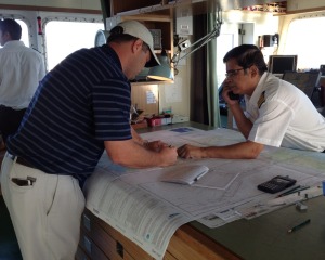
If you use a paper chart, you have a couple of options.
For official NOAA charts, updated to the time they are printed “on-demand,” you should check out the list of 19 NOAA-certified printers. To ensure the integrity, authenticity, and responsiveness of NOAA chart distributors, NOAA certifies these agents to sell official up-to-date NOAA charts. (NOTE: NOAA will revoke distributor status when the agent does not perform up to its terms of service. Effective April 26, 2016, NOAA has revoked the authorized distributor status of Bellingham Chart Printers.)
If you like to keep the latest chart handy for recreational use, and you want to print it at home, check out the NOAA BookletChart, in 8 ½ x 11” PDF format. Select which BookletChart you want, then download, print, and keep it on your boat. (We hear that some boaters put the pages into notebook sleeve protectors, to keep the pages dry.)
NOAA charts are also available as free PDFs. These PDFs are the same size as the traditional charts, so you will need to arrange for professional printing, or you can crop, save, and print only the section you need. (More info on the introduction of the PDF versions is at NOAA nautical charts now available as free PDFs.
If you use electronic systems…
NOAA has two types of charts that are popularly referred to as “digital.” Raster charts are geo-referenced digital images of the traditional chart. They are static. Electronic navigational charts, or ENCs, are produced from a vector database and are much more intelligent, with layers of data and interactive features.

NOAA raster navigational charts (NOAA RNC®) are available for free download from the Coast Survey website. Chart plotters and computer-based navigation systems often use commercial charts derived from official NOAA RNCs; in recent years, a number of the larger manufacturers have switched to NOAA raster charts themselves. These navigation systems, which also include tablets and mobile devices – at last count, there are over 60 mobile apps – as well as web mapping applications, increasingly use Coast Survey’s new chart tile services to update their data. These tile sets are updated weekly with the latest Notice to Mariners, as well as any other changes to the charts that are made that week.
NOAA electronic navigational charts (NOAA ENC®), produced from a vector database of features, support real-time navigation as well as collision and grounding avoidance. ENCs are used by ECDIS and other electronic navigation systems. ENCs are available for free download from the Coast Survey website, or the data may be viewed as a single, continuous webmap at ENC Online.
For more information…
…and to find the right chart in the format you need, bookmark Coast Survey’s interactive chart catalog.

Having a set of paper charts on board is still recommended for those times when Murphy’s Law take a bit out of your trip. One time I was making my way up the river and our chart provider failed to give us all the Columbia river charts. He didn’t think we were going all the way up to the Snake river in a 130 foot cruise ship. Thankfully we had old charts that we first used for planning then later as table covers (under glass tops) for passengers to follow us with. We use those chart until we got up to the snake and were able to get the rest of our ENC/RNC charts for the trip back.
Having a set of paper charts on board is still recommended for those times when Murphy’s Law take a bit out of your trip. One time I was making my way up the river and our chart provider failed to give us all the Columbia river charts. He didn’t think we were going all the way up to the Snake river in a 130 foot cruise ship. Thankfully we had old charts that we first used for planning then later as table covers (under glass tops) for passengers to follow us with. We use those chart until we got up to the snake and were able to get the rest of our ENC/RNC charts for the trip back.
With the use of ENCs we can add or remove data to reduce clutter to display only the information we need. This helps reduce errors and speeds planning. A common mistake I find with many of my students is that they fail to erase all their past work which causes them to mix old plots with the new ones. “A clean chart is a happy chart.” I always say when an error is made because of old plots.
There is also the cost of printing paper charts which just keeps climbing and the need to replace them more often as updates come out. No, I’m not going to mess with updating paper charts. It’s time consuming and it introduces errors when you’re updating them on four and half hours of sleep.
While I’m ok with phasing out paper charts, I still think it’s important that charting on paper continues to be taught in maritime schools. Once you fully understand how to plot on paper, the chart-plotter is much easier to understand given all those abbreviations that are used.
LikeLiked by 1 person
Reblogged this on Boating Safety Tips, Tricks & Thoughts from Captnmike and commented:
A very nice concise overview of NOAA Chart products, printed, electronic and free PDF downloads.
Remember if you use electronic navigation systems (GPS Chart Plotters) to check which NOAA products if any are supported by your unit or the unit you are thinking of buying, some will use the NOAA electronic charts directly.
LikeLiked by 1 person
I prefer the electronic charts for driving but always prefer paper for planning. Wish list…3D holographic.
LikeLiked by 1 person